Friday 19 July 2019

PCT 2019 ver 2 Day 9 July 18

Daily mileage 0

Home

I got up early to be able to use the showers (traveling on public transportation like small airplanes, you know), charge my phone and pilfer the wifi before all the other plundering hikers got on.

I made a somewhat vague plan as to how to get home from the rather remote Shelter Cove Resort. I had promised to travel out as far as Portland with a very nice young Tennasseean lady named Vitamin C  but when she got down to the eating area, she said she wanted to wait until later in the day because her friends from the trail were not in yet.

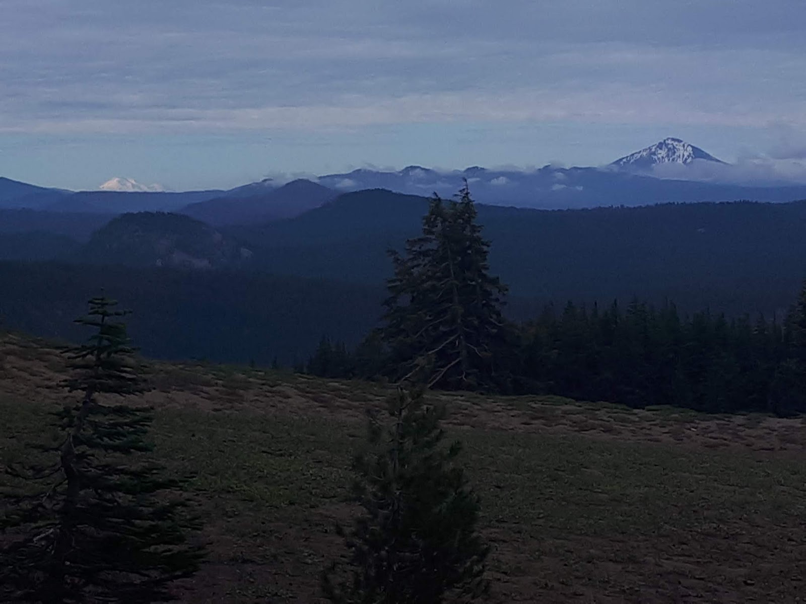
Had breakfast with Scooter with whom I have leapfrogged with pretty much the whole 8 days. Super nice lady.

The owners of the resort made arrangements to provide a ride up the two miles to the highway for me. Then I stuck out my thumb and the third vehicle past picked me up and gave me a ride right to Eugene. The only odd part was they dropped me off literally on the side of the I5. Rather odd hiking along the busiest freeway on the west coast after having spent 8 days in relative solitude hiking.  Oh well, it is all part of the adventure.  I limped into a Starbucks and started plotting a course home.

A Lyft ride to Target to get a shirt that did not have hiker stench embedded in it and then off to meet my hastily arranged four flights home.
Yesterday, I saw one other hiker in 25 trail miles. Today, I am in an airport crowd like this. Surreal.

After a few flight delays, my long travel day ended at around 1:00 am where my ever amazing wife was waiting patiently for me to limp home (this time literally) from the PCT once again.

So in summary, over the two seasons that I have been out beating my head in a very enjoyable manner on the PCT, I have hiked 1,530 miles of unique (discounting the repeated 167 miles of trail that I hiked this spring) PCT trail over a total of 81 days.  Will I return?  Not this year.  But never say never.  I still have 365 miles of what should be jaw dropping Sierra Mountains, 239 miles of Oregon which has been surprisingly beautiful and 509 miles of the Cascade Mountains in Washington to hike.  That is not a bad line up to keep me amused over the next few summers.

PCT 2019 ver 2 Day 8 July 17

Daily mileage 25
Trip mileage 175
Total PCT mileage 1530
Hiked from 5:45 am to 5:45 pm

It is not an alternate, it is a variant.


Got going at more or less my standard time. Much like yesterday, the first quarter mile or so was very painful on my right knee. Then everything got warmed up and I was back up to my lethargic top speed.

Made it to Windigo Pass where again some amazing Trail Angels provide us hot thirsty hikers with a water cache.
Easy hiking in the green tunnel

Water provided by amazing trail angels

At this point, I could stay on the true PCT or take an alternate trail called the Oregon Skyline Trail. The alternate, or variant as I prefer to call it gained less elevation, took a shorter route and went past several lakes. OST it is. Funny part is, this trail rarely was anywhere near the Skyline, but I guess a trail called the Oregon Through Scrubby Pine Forest Trail would not attract many hikers.

The hike went well. The trouble I have with this bum knee is that it gets grumpy if I stop for any time at all. So it kind of forces me to do a bit of a continuous march.


Lots of lakes and ponds along the away


The lakes were all very pretty  but the best was saved for last. Diamond View Lake had Diamond Peak as a backdrop. Just beautiful. If it had not been so packed with mosquitoes (as was most of the day), I would have camped there in a heartbeat.
The aptly names Diamond View Lake

I got to Shelter Cove Resort and was thrilled to see the grill was still open. Ended up sitting with a young lady named Vitamin C who is also fighting an injury. So she and I are going to figure out a way out of here tomorrow and fly back to our respective corners of the world.
Home for the night


I also ate with Walkabout and Scooter. I met both of these hikers on my second day out. I had something with a connection with Scooter (lovely lady from Dallas) because we hiked at pretty much the same pace and camped together a few times. I had something of a special connection with Walkabout because he is the only other hiker I met who was subjected to the old nudist hikers.

But back to making travel arrangements. That is right, I am quitting this damned trail yet again. My knee is sore enough that I am afraid of doing long term damage if I keep hiking on it.  At 63, I guess I had  better start thinking about preserving all functioning joints and parts!

PCT 2019 ver 2 Day 7 July 16

Daily mileage 23
Trip mileage 150
Total PCT miles 1505
Hiked from 5:45 am to 5 pm

The day that almost did not happen.

When I crawled out of my tent this morning  I discovered a rather troubling thing: I could not put any weight on my right knee.  That knee have me issues on my aborted PCT restart in May but it had been fine so far. Given that I was only about two miles from a highway, I had a big decision to make. Carry on with the PCT or head back to the highway. So I figured out a stretch that helped and walked about without my pack to loosen up the knee.

That all seemed to work, so off up the trail I went. Oh yeah, the other factor was I had no idea where the highway leads. I would not even know which side of the road to stand on to hitch!  That is one of the odd things about hiking the PCT, or any other trail for that matter.  The maps you carry cover the trail and maybe a mile on either side of it.  What exists beyond that scope is a big unknown.  So arriving at a highway crossing, you just look and wonder where the blacktop leads.

So off up the trail I hobbled.  Luckily, even by PCT standards, it was remarkably easy hiking.

First up was Mt Thielsen. From a distance, it looks rather dark and foreboding. Kind of a Mt Doom aura. But up close and personal, it was gorgeous. The trail took me around about 180 degrees of the mountain and it was majestic from every vantage.

When I got to the trail junction with the trail that summits the mountain, I knew the PCT went downhill for a bit.  So off I go on a trail that goes downhill. But, not the right trail that goes downhill!  Luckily, I suspected I was on the wrong trail after only 10 minutes mainly because the grade going down was very un-PCT like.  Too steep.  I checked the Half Mile app and discovered I was indeed off trail.  All in all, could have been worse.


Mt Thielsen from several angles

I started hitting snow patches on the northern flanks of the mountain. Not enough to be a bother  but a definite reminder of how much snow blanketed the area this winter.

Modest amounts of snowy trail


As I was limping along, I could see a sign on a tree coming up. It was the high point of Oregon and Washington. So obviously there will be no more uphills ahead!

I actually misplaced the trail twice today. On both occasions, I simply did not pay attention to trail signage and chose the wrong trail at a junction. On both cases, the lack of recent foot prints or the steepness of the grade gave away the mistake.

I had targeted the camp I am in now early in the day because it has the first water available in 16 miles. I failed to read the details about the spring and found out first hand that it is hellalong down the hill and the is a reception committee of a million mosquitoes awaiting your arrival. Oh well, I needed the water. 

Again, no picture of camp because of the mosquitoes.

PCT 2019 ver 2 Day 6 July 15

Daily mileage 22
Trip mileage 127
Total PCT mileage 1482
Hiked from 6 am to 5 pm

Crater Lake Day

I got up a bit later than normal because I knew I only had a little over 2 miles to the Rim Village and breakfast.

Unlike the PCT, any other trail that I have hiked has taken the challenge of getting up a hill seriously. The PCT tends to meander about, kind of gently easing you up  the hill.  Well the connector trail to the Rim is not the PCT and it took getting up the hill very seriously. But I made it in plenty of time for breakfast. And the meal was well worth the hike up.

After sating my desire for both food and coffee, it was time to hike the Rim.  I mean, what else can I say other than wow. I chose to end my PCT hike in 2017 because the Rim Trail was closed due to forest fires. Having seen the trail today, I made a good decision two years ago.  It was simply amazing.
Early morning mist on Crater Lake


Pictures do not capture just how beautiful the lake was 

Proof I was actually there

The trail parallels the Rim Road which was awash with clean smelling car tourists. I caught a few wrinkled noses on my way past. Hey, I showered yesterday.

At one point, there was a "Trail Closed" sign across the Rim Trail. Not wanting to road walk any of this magnificent section, I simply walked around the sign. Everything was perfectly fine with that decision until I got to the other end of the closure. There was a park ranger ahead. He was actually shoveling snow from the trail in the one stretch that could possibly be close to sketchy. When I got up to him, he was just as friendly as all get out and wished me a good hike. My theory is that PCT hikers are regarded as back country hikers that can handle a little snow whereas the car tourists are more front country hikers, usually in flip flops with a gaggle of kids in tow and they should likely not be venturing into a trail with sloping snow. Snobbish, perhaps, but that is my theory.

Sadly, all good things must come to an end and it was back down to reconnect with the actual PCT. And back into the green tunnel. But at least it was very easy hiking.
Mt McLoughlin on the front right and way back on the left, one last look at Mt Shasta

Next up, Mt Thiessen, looking a bit like Mt Doom from this angle


I have been trying to do twice daily videos which I embed once I am back home. But I have had to suspend that practice because my phone will not charge. Arg, electronics and hiking do not mix well. Hopefully I can get to the bottom of this when I get to the next real town, Sisters.
Home for the night

PCT 2019 ver 2 Day 5 July 14

Daily mileage  17
Trip mileage 105
Total PCT miles 1460
Hiked from 5:15 am to 4 pm

Race to Mazama Village


I have to start out by saying I had the best sleep ever last night. Man did that ever feel great. I was up at 5 gung ho to get the job at hand done. And that job was to hike the 15 miles to the highway that leads to Mazama Village. The going was easy so I was at the roadside by 11.

Lots of old burn areas
Forested and very mosquito prone trail

Entering the Natonal Park


I trekked down to the Village which is little more than a campground, restaurant and store. I had flirted with blowing the big bucks on one of their cabins, but they were all spoken for.

So I had a mediocre burger and then spent several hours pilfering their wifi.  I was able to message with my family and managed to get a couple of internet choirs like downloading maps and books to read.

After a quick resupply and shower it was time to reconnect with the trail.

I am camped at the junction of the PCT and the side trail that will take me up to the actual rim of Crater Lake. Tomorrow is going to be a great day seeing the lake for the first time.

I always try to take a picture of my campsite each night. But tonight, the mosquitoes were just insane, so I tossed everything inside my tent, bailed in after and sealed up. Sorry, but there was no way I was going back out there.

Thursday 18 July 2019

PCT 2019 ver 2 Day 4 July 13

Daily mileage 21
Trip mileage 88
Total PCT mileage 1443
Hiked from 5:45 am to 4:30 pm

Devils Peak done


Got up around 5:30 after a particularly poor night's sleep. There was a deer rustling around outside my tent for what seemed most of the night.

Got the flat areas done quickly and then started the climb up to Devils Peak. The Oregon PCT showed some real teeth on that climb. A couple of times I had to stop and check my GPS to make sure I was on the right trail. It was steep in places and the PCT is rarely that.
Getting up into the sub-alpine

First snow on or near the trail

South side of Devils Peak

Got to the top and was thrilled to see only a few patches of snow on the north face. Until a couple of weeks ago  this descent has been very sketchy. 
Tough trail building through scree slopes

North side of Devils Peak. The one large snow patch was the only bit that was challenging to cross

Again, north side of Devils Peak

The rest of the day was spent wandering along in the forest. I was not on top of my hiking game and the afternoon miles seemed to come hard. I packed it in early because I am set up nicely with a 15 mile day to get to Mazama Village and Crater Lake tomorrow.
Home for the night

PCT 2019 ver 2 Day 3 July 12

Daily mileage 22 plus 2
Trip mileage 67
Total PCT mileage 1422
Hiked from 5:30 am to 5 pm

The day I saw a bear instead of bare hikers.


For whatever reason, sleep was hard to come by last night. On factor could have been the rather odd hiker (and I hesitate to assign him the label of hiker as he is wearing blue jeans, has a mucky big hunting knife strapped to his hip and does not carry a sleeping bag, pad or tent) thought he could sleep through the night simply by snuggling up to the fire. Trouble with that is the firewood is all kindling size so he was up rustling around stoking the fire about 30 feet from my tent all night.

But, off I went at near the crack of dawn. I had only gone about a mile when I could hear something grubbing around below the trail. It was a bear. He or she was totally oblivious to my presence until I snapped a picture.
Look hard and you will see the bear


Trail through lava fields


A lot of the first 10 miles was through old lava flows. The crews who built this trail did an absolutely amazing job as the tread through these areas was really great. I also got my first look at Mt McLoughlin as I was passing through one of these flows. I believe that I am camped on the northern flank of that mountain tonight but all views are hidden behind trees.


Mt McLoughlin

I got 10 in by 9:30 (bless your easy little heart Oregon) and that put me at a highway from which the Fish Lake Resort is only 2 miles away from the trailhead. I was not going to bother going there until I spoke with a Sobo (south bounder PCT hiker) who said the food was amazing there. So I hitched a ride to the resort and indeed, the food was wonderful. I even managed to get a soapless shower in.

Now you see it

Now you don't. Magic!

Feeling a bit guilty about the diversion, I figured the fastest way back to the trail was a side trail, hence the extra 2 miles in today's total.

Then it was up the only real climb of the day, which turned out to be an exceedingly easy 1200 footer spread out over 5 miles.  After I got over the top, I bumped into a Sobo hiker. I could not help to notice that he had his mosquito head net on. That was rather odd as they were not really out in force. Then I went another mile or so and it all came clear. Just a flipping wall of the little blood suckers. Setting up camp tonight was predicated around getting the tent up and me and all my stuff in with as few of the little burgers  as possible.
Mt McLoughlin getting closer


Home for the night, shared with 10 million mosquitoes 

All in all, it was a very good day.

PCT 2019 ver 2 Day 2 July 11

Daily mileage 22
Hike mileage 45
PCT total mileage 1400
Hiked from 6 am to 5 pm

Granny porn on the trail!


That was a day of the highest highs and lowest lows.  It all started out in a normal fashion.  I was cruising along to the tune of 10 miles by 10 am which is always a sign of a good hiking day. Much like yesterday  the trail was very easy and the temperature was good.
Strange little dam beside where I camped

I decided to drop down to a car campsite (Klum Landing Park) beside a lake because I was a little short of water. Which meant a flush toilet at exactly the right time. Then there was a picnic table overlooking the lake, so an early lunch it is.

As I was enjoying my gourmet meal of ramen noodles, a nice lady felt sorry for me and invited me to have breakfast with her family. Cheesy eggs, back bacon, a croissant and coffee, oh yeah.  Ross and Tamra and five children, if you ever read this, thank you.
A little trail out of the green tunnel
Lunch lake

So then it was off up the trail.  There was a minor climb of about 1,500 feet to tackle straight away.  But because this is Oregon  it was an easy climb. About half way up, I spotted a group of hikers heading my way. From a distance, I was trying to figure out what it was about the lead hiker that seemed odd...oh Jesus, she is naked. Oh Jesus, they are all naked. And they are older than dirt.  I know there were 8 of them because I have the image of 8 sagging boobs and 4 shrivelled dicks seared into my brain.  And as if all that was not weird enough, the last guy stopped and took my picture like he had never seen a fully clothed hiker before.

After that, things got back to normal. I hiked with a true thru hiker (she completed the Sierra) from Quebec City for a few miles. She is doing 40's so she had to slow down for me and I had to speed up for her.

I am camped at an odd little cabin out here in the middle of the rough and tumble. There are three other hikers here so it was nice to have some dinner conversation. Sub Zero (south bound hiker) and Scooter (fellow north bound hiker) are great.  The other guy (apparently perpetually stoned hiker should be his trail name, but it is something else) is ok.
Some views

Home for the night